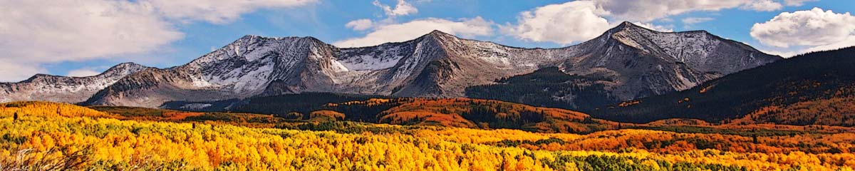

Lime Ridge is a peak in Marble Range Provincial Park. It is one of the karst limestone peaks accessed from the Jesmond Road. Lime Ridge is a barren limestone 7 km-long open ridge with rugged views in every direction. There are 3 routes that can be taken to get to the top of Lime Ridge. The one best known is from the southwest, going up the Porcupine Creek FSR to a small Rec Site, then following a good trail to the south end of Lime Ridge and/or Porcupine Peak. There is also a steep route on the west side near the middle of the ridge which follows an old mining road to a limestone quarry and from there, it is a very steep scramble. A good trail also approaches from the northwest. At about the 19 km mark up the Jesmond Road going north, there is a concrete house foundation with a creek beside it. A trail picks up there, winding through the trees, heading upstream into a valley between Mad Dog Mountain and Lime Ridge. At 4 km, a fork goes left (north) to Mad Dog Mountain. The trail continues up Foundation Creek. The creek disappears now and then (limestone underground passages). At a meeting of several gullies a trail starts to wind up the north side of the ridge for 2 km, emerging onto the open alpine rocky hilltop.

On our first two times up Lime Ridge we followed this route to the top, then wandered along the ridge before returning by the same access trail. On other hikes to follow, we followed the other two routes, one of them on the snow.
The top of Lime Ridge is an unique karst ecosystem. There are a few trees on the north side of slopes and in pockets, but the whole area is dry. Water seeps through the limestone gravels and leaves sparse vegetation. Only mat-forming plants rooted underneath rocks can be seen in summer. There are a series of rocky knolls along the ridge top. Cliffs drop off on the west side down to the Jesmond Road and beyond to the Edge Hills.
In the west across the Fraser River are the Coast Ranges – the Camelsfoot Range and the Shulaps Range. On the north is Mad Dog Mountain and Mt. Kerr. To the northeast is Wild Horse Ridge and Mt. Kerr. To the south is Porcupine Peak and Mount Soues. (I have hiked most of these.) Just out of sight to the northeast is the flat-looking Cariboo lands. Forest fires have run through the Marble Range, so a number of the trails wind through blackened forests. This is backcountry, wild and rugged, for intrepid hikers only.
Future posts will include other routes up Lime Ridge, as well as Wild Horse Ridge, Porcupine Peak, Mt. Kerr, and the Jesmond Lookout.
Shared here are some photos from the hike up the Lime Ridge Trail from the north. The images are shared as a Google Photos album slideshow or the link can be clicked to go directly to the album and more information, including captions.
More Information:
- Porcupine Creek to Lime Ridge in the Marble Range
- Porcupine Ridge to Lime Ridge
- Lime Ridge Wildflowers
- Mad Dog Mountain
- Mt. Bowman Hike
DAS
